Jan 26, 2020
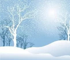
Image: Snowy winter day - clipartpanda.com
It's winter in the Northern Hemisphere and here from metoffice.gov.uk are some facts about winter weather.
How does snow form?
Snow forms when temperatures are low and there is moisture in the atmosphere in the form of tiny ice crystals.
What is snow?
Snow is defined as 'solid precipitation which occurs in a variety of minute ice crystals at temperatures well below 0 °C but as larger snowflakes at temperatures near 0 °C.' It is one of the UK's most striking weather phenomena causing a transformation of the world around us, but it can also lead to the potential for disruption.
How does snow form?
Snow forms when tiny ice crystals in clouds stick together to become snowflakes. If enough crystals stick together, they'll become heavy enough to fall to the ground.
Snowflakes that descend through moist air that is slightly warmer than 0 °C will melt around the edges and stick together to produce big flakes. Snowflakes that fall through cold, dry air produce powdery snow that does not stick together.
Snow is formed when temperatures are low and there is moisture in the atmosphere in the form of tiny ice crystals.
How cold does it have to be to snow?
Precipitation falls as snow when the air temperature is below 2 °C. It is a myth that it needs to be below zero to snow. In fact, in this country, the heaviest snowfalls tend to occur when the air temperature is between zero and 2 °C. The falling snow does begin to melt as soon as the temperature rises above freezing, but as the melting process begins, the air around the snowflake is cooled.
Snowfall can be defined as 'slight,' 'moderate' or 'heavy'. When combined with strong winds, a snowfall can create blizzards and drifts.
If the temperature is warmer than 2 °C then the snowflake will melt and fall as sleet rather than snow, and if it's warmer still, it will be rain.
'Wet' snow vs. 'dry' snow
The size and composition of a snowflake depend on how many ice crystals group together and this will be determined by air temperatures. Snowflakes that fall through dry, cool air will be small, powdery snowflakes that don't stick together. This 'dry' snow is ideal for snow sports but is more likely to drift in windy weather.
When the temperature is slightly warmer than 0 °C, the snowflakes will melt around the edges and stick together to become big, heavy flakes. This creates 'wet' snow which sticks together easily and is good for making snowmen.
Snowflake
Find out more about snowflakes. How do they form and what gives them their unique appearance?
Snowflakes are one of the most recognisable symbols of winter weather. Every snowflake is unique and there is an infinite number of possible shapes they can form.
What is a snowflake?
A snowflake begins life as a tiny droplet of supercooled water which freezes in the sky to create an ice crystal. The droplet becomes frozen either because temperatures are sufficiently cold (it would have to be −35 °C or lower) to freeze to other droplets, or in clouds above -35 °C, they can form around a nucleus such as a dust or pollen particle.
Once the ice crystal has formed, if the conditions are right it will begin to grow, as water molecules in the air are deposited onto the ice crystal as it falls through the air, and clump together to form a snowflake.
Why are snowflakes hexagonal?
All snowflakes contain six sides or points owing to the way in which they form. The molecules in ice crystals join to one another in a hexagonal structure, an arrangement which allows water molecules - each with one oxygen and two hydrogen atoms - to form together in the most efficient way.
Snowflakes are unique
Part of the enduring appeal of snowflakes is their intricate appearance and near infinite variation, often leading to the assertion that all snowflakes are unique. While this in some sense impossible to test, as a general rule it is entirely true. The number of possibilities of changes in temperature and humidity as the snowflake falls to the ground is limitless. If you look closely at a snowflake you will see countless individual features, all of which could have formed ever so slightly differently in direction or shape owing to the slightest change in the environment in which it formed.
What makes snowflakes white?
While snowflakes appear white as they fall through the sky, or as they accumulate on the ground as snowfall, they are in fact totally clear. The ice is not transparent like a sheet of glass is, but rather is translucent, meaning light passes through but not directly. The many sides of the ice crystals cause diffuse reflection of the whole light spectrum which results in snowflakes appearing to be white in colour.
Types of snowflake
Whilst the variation of snowflake shapes is infinite, they can be broadly categorised into groups which give an indication as to what conditions the snowflake formed in. Three of the broad types are:
Dendrite snowflake
Perhaps the most eye-catching type of snowflake, the name means 'tree-like' recognising their branching structures . They form in very low temperatures of -20 to -25 °C where the atmosphere contains abundant moisture to allow the snowflake to form intricate patterns.
Thin plate
Plates are essentially part-formed dendrites, the begin to form their intricate patterns but cannot obtain sufficient moisture to form the branches so form a less intricate flat plate. These tend to form at warmer temperatures where there is less moisture in the air.
Sector plate
Similar to a thin plate, a sector plate snowflake again lacks moisture but forms a hexagonal structure often with a star-like shape in the centre and the more visible attempts to branch.
Sleet
Sleet is a type of solid precipitation that occurs during winter weather.
Sleet has no internationally agreed definition but is reported in meteorological observations as a combination or mix of rain and snow.
Essentially, it is frozen precipitation that partially melts as it falls and has begun the melting process before it reaches the ground, so you will see both raindrops and snowflakes falling from the sky.
This is why forecasting snow can be so tricky, since tiny variations in temperature through the atmosphere can mean the difference between precipitation falling from the cloud as rain, or quickly turning to sleet or snow.
Freezing rain
Freezing rain is a rare type of liquid precipitation that strikes a cold surface, and freezes almost instantly.
The conditions needed for freezing rain are quite specific and we don’t see this phenomenon very often in the UK. It can produce striking effects, as the rain drop spreads out momentarily across the surface before it freezes, encasing the surface in a layer of clear ice.
However, it is not just these eye-catching scenes which the freezing rain can bring; the weight of the ice can sometimes be heavy enough to bring down trees and power lines, and the glaze of ice on the ground effectively turns roads and pathways into an ice rink. The freezing rain can also prove extremely hazardous for aircraft.
Freezing rain is more common in other parts of the world, for example in the USA, where weather systems produce a lot of freezing rain. These are called ice storms, and if enough glaze collects on trees or power lines, the weight of the ice can cause them to break and can result in disruption on a large scale.
How does freezing rain form?
Very often, precipitation first falls from a cloud as snow (when it is cold enough high up where the cloud is). If it falls through warmer air before reaching the ground, it can melt and turn to rain droplets.
On rare occasions, if it then falls through cold air again just before hitting the ground, the droplets can become ‘supercooled’ and this means that they are still falling in liquid form, even though their temperature has fallen below zero. When this ‘supercooled’ droplet hits the ground (which is below zero too) it spreads out a little on landing, and then instantly freezes, encasing the surface in a layer of clear ice. This is why it is called freezing rain.
How does the droplet become supercooled?
We all know that water freezes at 0 °C but in the same way that raindrops need a nucleus (microscopic particles of dust or dirt) to form around, water droplets can only freeze around an ice nucleus. However, it is possible that water droplets can exist several degrees below zero and remain in liquid form without a nucleus. This is when they are supercooled.
Supercooled water droplets occur in clouds a lot of the time, especially in winter, and they form a very important role in the way that rain forms.
Freezing rain tends to start its life as snow, ice, sleet or hail, but passes through a layer of air that’s above 0 °C on the way down to the ground, melting into a liquid water droplet. If these droplets then fall through a zone of sub-zero air just above the ground, they become supercooled. When these supercooled droplets strike surfaces that are close to or below freezing, they freeze on impact forming a glaze of ice.
Ice pellets
Ice pellets are a type of solid precipitation that have a diameter of less than 5mm. They are spherical or irregular and rarely conical.
Ice pellets form when snowflakes start to melt as they fall from the cloud, then fall through sub-freezing air where they re-freeze into grain-like particles.
Sometimes the snow may only partially melt and fall as snow pellets encased in a thin layer of solid ice.
Ice pellets tend to be smaller than hailstones and bounce when they hit the ground. Like snow, they accumulate on the ground but form a smaller, denser covering which can be hard to clear away.
They tend to occur in brief showers from tall cumulus clouds in the winter months.
Snow grains
Snow grains are a very small form of solid precipitation.
This type of precipitation appears as very small white and opaque grains of ice. These grains are fairly flat or elongated with a diameter generally less than 1mm.
Snow grains are the solid equivalent to drizzle.
Blizzards and snow drifts
Originating in North America, a blizzard refers to a cold, strong wind that is laden with snow which significantly reduces visibility.
What is a blizzard?
At the Met Office we define a blizzard as moderate or heavy falling snow (either continuous or in the form of frequent showers) with winds speeds of 30 mph or more and a reasonably extensive snow cover reducing visibility to 200 metres or less.
The phrase originated in North America, the term originally referring to a blast of gunfire.
How do blizzards occur?
Blizzards can occur either when snow is falling in windy conditions or when it is lifted from the ground by strong winds (known as a 'ground blizzard') or a combination of both facts.
A 'whiteout' is an extreme form of blizzard in which downdrafts and heavy snowfall combine to create a situation in which it is impossible to tell the ground from the sky.
What are snow drifts?
A drift is where snow gets piled up as the wind blows across it. Dry, powder snow is the easiest type of snow to move around because it doesn’t stick together like wet snow. The air temperature and dew point must be below 0°C to give us cold and dry air.
The next ingredient is the wind, which must be at least 10 mph to get the snow on the move. The stronger the wind the more it’s shifted and you can end up with really deep areas of snow piled against road sides, houses or anything that’s facing the wind.
Share this article with friends!
Tags:
#snowy#winter,#cold#starzpsychics.com,#starz#advisors